Rethinking Neglected Waterways: A Water-Sensitive Approach in the Design Process
All sketches by Akshay Badwe, Associate Landscape Architect
Water is life. Almost all the cities have prospered, and civilizations have flourished over thousands of years due to their access to water. The rivers have been used commercially for trade and transport routes. The fertile land along the river attracts various cultures. Diverse cultural perspectives have evolved based on cultural philosophies. For example, Hindus' religious attitude toward the river is approaching the river, and they capture divinity into everyday life, whereas Muslim philosophy sees water as a source of aesthetic pleasures. These philosophies developed landscapes and built environments around their access to water. The Hindu people developed temples, and Muslim philosophy transformed several monuments, including the Taj Mahal, as a homage to water.
Ghats (stepped areas) in Varanasi and the Taj Mahal shows cultural landscapes and built environments shaped based on the distinct philosophies of the Hindus and Muslims
However, in today’s context, we take water for granted. After the Industrial Revolution, rivers became a massive feat of engineering. The approach seems to be a need to “getting rid” of water as quickly as possible. Ian McHarg’s “Design with Nature” concept brings ecological ideas in planning to the forefront of development. Although planners understand ecological balance and the benefits of having rivers and water bodies, they have become a second priority due to immense urban pressures. According to the World Bank, 56% of the world’s population lives in cities, which will double by 2050. That means 7 of 10 people will live in cities globally. The recent catastrophic floods and climate change have amplified these issues. The situation is dire in the developing world since rapid urbanization causes rivers to be utilitarian drains. In the city of San Diego, for example, creeks, rivers, and watersheds fall under the supervision of the Stormwater Department, which deals primarily with moving water through and out of the city as quickly and efficiently as possible.
Various civilizations flourished along the river
After the Industrial Revolution, polluted rivers caused environmental degradation and social behavioral changes. It is still true in the developing world.
Creating sustainable cities with clean rivers that brings ecologically sensitive public spaces to the city core.
Water covers 71% of the earth’s surface. Only 0.5% of the water is available in freshwater. The remaining water is found in the earth’s oceans, glaciers, polar icecaps, atmosphere, and soil. Conversely, 785 million people on our planet lack access to safe, clean drinking water. The World Bank predicts that by 2025, 2/3 of the global population will have a shortage of fresh drinking water. A lack of access to clean drinking water would cause disease, which would cause an inadequate supply of food, causing hunger and starvation and ultimately affecting the global economy (7). Water is an important resource, and an integrated water management approach is necessary to consider water systems, environmental protection, and design holistically.
Hydrologic water cycle – It is essential to provide interventions in the watershed due to interconnected ecology
Multiple approaches are being explored to solve water challenges, including “low-impact development” in the United States (5), “Sponge City” in China, and “Water Sensitive Urban Design” (WSUD) in Australia (6). All these techniques suggest we need a comprehensive multidisciplinary strategy to improve ecological balance and protect Mother Nature from climate change.
Almost all cities have rivers and waterways. Rapid urbanization and weak urban policies without strong implementation directly deteriorate residents’ interaction with rivers and waterways. Infrastructure barriers along the rivers and waterways are detrimental to riverfront development. Historically, highways and railroads were built because capturing land for infrastructure development was easier. These barriers assist in the loss of access to waterways. Without access, they become unsafe and neglected. Conversely, there is an opportunity to make these viable public spaces since water flows through most cities. We should promote a public space adjacent to the water. It would also bring ecology into the city core (2). Ecologically, colluvial and alluvial soil is good for vegetation and crops, benefiting wildlife and aquatic life. It also very simply connects people to nature. Riverfronts also reduce urban heat island effect by improving tree canopy. Riverfronts promote carbon sequestration to remove carbon dioxide from the air and assist in its absorption into vegetation. An increase in carbon dioxide is a primary cause of the increase in Earth’s temperature. Rivers also reduce sulfur and nitrogen from the air, which helps to make spaces healthier (1).
Bringing ecology into city core
Infrastructure barriers along the river reduces access to river
Most importantly, public places along the river could be a catalyst for revitalizing neglected waterways, which would benefit the economy. For example, restoration of the South Platt River in Denver triggered 36% property value, directly resulting in tax revenue. It also provides $1.4 billion in economic benefit annually to Denver for all indirect ecosystem services for the rivers and their tributaries. And it provides green jobs for the community (1).
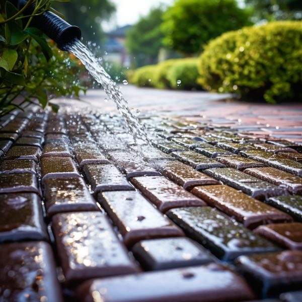
Providing pervious surfaces along the river
Rivers or waterways are an essential source of recreation for communities. At the same time, they are a linear ecosystem that connects regions together. Riverfront development is a balance between ecology, flood protection, and amenity 2. Athletic or recreation fields and parks along rivers are potential floodplain areas (these could include agriculture, campsites, and walking trails). Their uses could be temporary but essential gateways for the residents to enjoy the outdoors. The development of these areas has significant positive momentum towards quality of life and people’s health. These are also essential parts of the ecosystem where the higher probability of floods can be absorbed. It is essential to keep pervious areas within floodplains. Good zoning analyzes the percentage of rainfall—usually, 1% of the floodplain has development restrictions. Keeping recreational fields and nature preserve areas at 1% minimum within a flood zone is recommended. However, we believe this number is a little low and should be reconsidered.
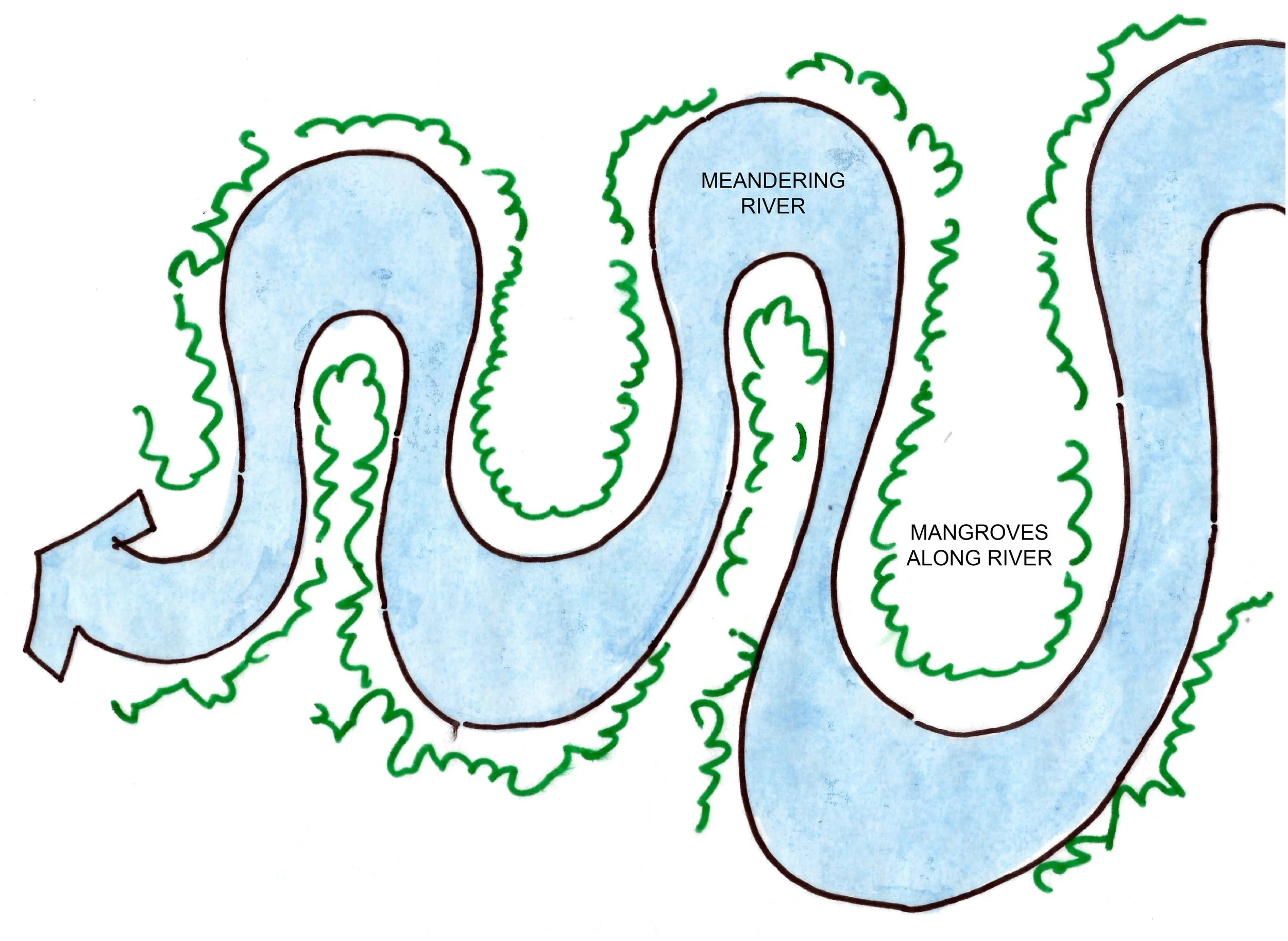
Water flows faster on the cut bank channel, whereas a meandering river can hold a lot of water and also promote ecology along the banks of the river. Embankment walls and promenades would focus on amenities, providing more access to rivers and waterways. Vehicular access would often become a nuisance and increase safety issues and should be kept to a minimum (2).
Water flows fast and stores less water in linear water channels. On the other hand, meandering rivers store more water, and promote water percolation into local aquifers.
The multiple ways to revitalize Waterways
Broadening the intermediate level with pedestrian access along the waterfront, integrating recreation areas and retail, and providing authenticity to the place to generate more human interest. For example, waterfront in San Antonio, Texas
Waterfront in San Antonio, TX
Riverbank steps along the waterways would create clear sight lines and provide access to water. However, it is essential to include pervious surfaces. Stone steps in the water create a dual purpose. They act as rip-rap walls and stepped areas for access.
Creating overhangs and balconies along the waterways in historic cities provides more “eyes” on the environment and helps to promote safety.
Floating islands provide valuable ecological habitat. It is a low-cost, sustainable way to improve water quality. It removes phosphorous, which is the main contributor for increasing algae growth in water. It is also aesthetically pleasing as well as reduces wind and erosion impacts at the shoreline.
Providing vegetation is the best solution for waterfront development. It reduces water temperature, reduces soil erosion, provides habitat and aquatic life along the shore. It further reduces flood impact. It also helps nature take its course.
Providing dikes and pathways along the waterways as a means of transportation within the region. Often, areas along the rivers are flat, which provides an ideal space for bikers. Converting transportation areas for waterways would reduce the dependence on road transport and resolve transportation issues in the city core (2).
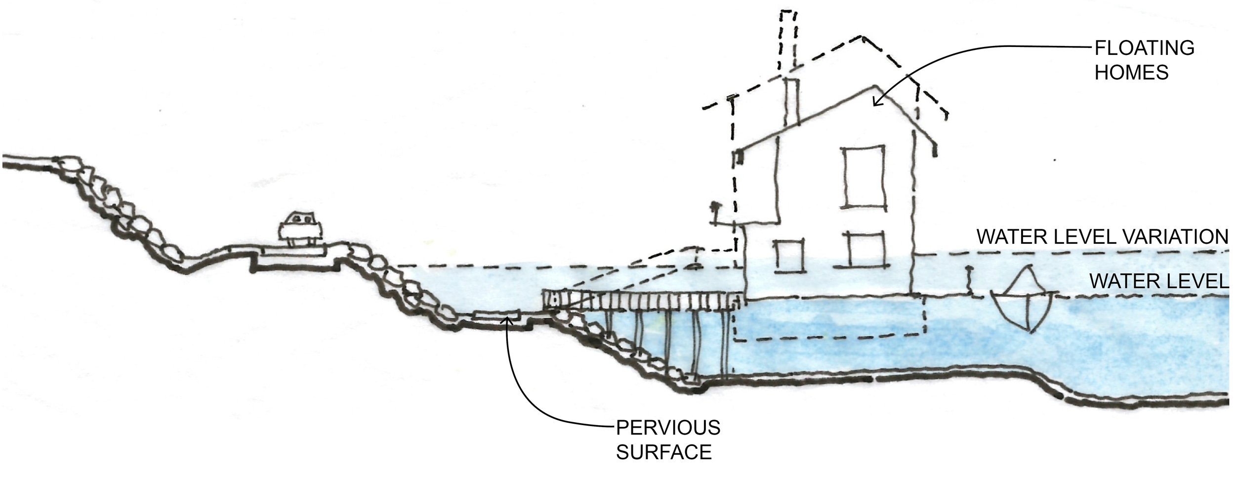
Building structures on piles reduces the overall footprint of the impervious areas (2).
Building houses on stilts
While we study interaction with the water in the urban core, it is important to acknowledge that climate change threatens humanity. Climate change is real. According to NASA, since the pre-industrial period, human activities have been estimated to have increased Earth’s temperature by one degree Celsius, and it is increasing rapidly by more than 0.2 degrees per decade. This climate change is affecting humidity and rainfall patterns, creating floods and thunderstorms, to name a few. NASA identified that global sea levels have risen eight inches since 1880 and will likely rise further by one to 6.6 feet by 2100, directly impacting our coasts. These changes will affect infrastructure and affect the economy directly. It will also affect the ecology dramatically. Therefore, using stormwater management practices, conserving and protecting water resources is essential.
Effects of Climate Change
Principals of designing with water include protecting and enhancing creeks, rivers, and wetlands within an urban environment. The reuse of stormwater, recycled water, and gray water reduces dependency on potable water. Reducing peak flow and runoff within urban environments simultaneously provides infiltration and groundwater recharge. Integrating stormwater treatment into the landscape offers multiple beneficial uses: wildlife habitat, recreation, and open public space.
Strategies to Design with Water
• Use reduced building footprint or impervious surfaces around the building or go vertical if possible.
Porous paving
Sand filters
Sedimentation basin
Construct or preserve active wetlands.
Swale and buffer strips adjacent to roadways
Preserve and enhance ponds and lakes
Use of a native plant palette with minimum water use in new plantings
Provide vegetated swale
Provide rain gardens
Stormwater planters
Use of cisterns for collection
Use vegetation for stormwater filtration purpose
Use bio-retention systems to slow peak event stormwater run-off
Bioretention basins
Floating homes are predominantly used in the areas which are affected by frequent flooding. The access to floating is mainly through jetty. These units require a lot of maintenance. However, these units are highly suited for recreation and hospitality markets (2).
Breakwaters are very useful to reduce ocean currents and protect shorelines. Currently, breakwaters are being installed in New York and other major cities worldwide (4). A recent technological innovation has developed an eco-concrete module. Eco-concrete’s chemical composition promotes the growth of microorganisms. It protects the shorelines while promoting fish and wildlife within water system (8).
Overall, rivers and waterbodies are low areas in the watershed. It is vital to provide interventions to the overall catchment area on every scale, including homes, and strategic planning to promote positive economic impacts and enhance ecologically responsive without compromising people's health and safety. It requires a high level of policymakers’ determination and strict enforcement while involving the “user” in the decision-making process for long-term sustainable development.
Resources
Written by Akshay Badwe, ASLA, PLA
Associate Landscape Architect
Akshay earned his bachelor’s degree in Architecture and two master’s degrees in Landscape Architecture and Urban Design. With extensive experience in the profession, Akshay is a licensed landscape architect in California and Maryland, as well as a licensed architect in India. Akshay focuses on the relationship between urbanism and landscape architecture. Throughout his travels and working globally, he has a strong appreciation for diversity awareness and has rich global development perspectives.


